We awoke early in the morning to drive to nearby
Arches National Park. Our hope was to get there soon after they opened in order to beat the crowds and the summer heat. Arches National Park is best known for...arches--over 2,000 of these sandstone formations. We didn't plan on seeing most of the arches, just the main highlights.
After entering the park, we first drove to the start of the hike to the Delicate Arch, Utah's quintessential natural formation that adorns its license plates. Having learned my lesson from the previous day, we all carried hydration packs full of water.
 |
At the start of the trail is the Wolfe Ranch, a primitive and remote
settlement that dates back to the turn of the 19th and 20th century. |
Despite our attempts at an early start, the sun and heat were already out in force once we got started. To say that the hike was grueling is an understatement.
 |
| The trail led up a barren rock face for about 1.5 miles, gaining 500 feet in elevation. |
 |
| Our legs ached from the rocky incline, and our faces were singed by the penetrating rays of the sun. |
 |
Highwaymen were another peril on
the journey to the Delicate Arch. |
 |
After standing next to the Delicate Arch, we
gained an appreciation of it's immense size. |
 |
| The lack of other interesting geological features nearby further accentuates the spectacle of the Delicate Arch. |
 |
On the way back from the Delicate Arch, we viewed more petroglyphs,
evidence of habitation in the past by indigenous people of this region. |
We were all pretty hot and cranky from the hike to the Delicate Arch, but we still had plenty of arches to see. We drove to the next area to hike The Devil's Garden Trail where eight impressive arches can be seen. The path is broken up into the easy "main trail" followed by a more rigorous "primitive loop trail" where hikers would lead up a rocky path with a 500 foot elevation change. The entire journey for both trails is 5 miles. While the arches in general were impressive to see, none of us were interested enough in them to do the full Devil's Garden Trail in the sunny 95 degree heat. We decided to wuss out and just hike the main trail.
 |
| With a length of 100 yards, a game of football can be played atop the Delicate Arch. |
 |
| The Skyline Arch formed when a large boulder broke off and fell from inside the rock formation. |
By noon, we had our fill of arches and hot sun. On the long drive back to exit Arches National Park, we stopped by the many interesting rock formations that were officially named (likely by some chemically-impaired people.)
 |
| "Balanced Rock" |
 |
| "The Three Gossips" |
 |
| "Sheep Rock" |
 |
| "The Organ" What?!? |
We left the park and drove the short distance back to Moab. We had a late lunch at a relaxing, vegan-friendly restaurant called
Eklecticafe Coffee and Collectibles. We all ordered meat dishes. We were initially a bit wary because the dining area was mainly outside on their patio. However, the copious amounts of shade made the air quite comfortable.
 |
| On the outskirts of Moab, The Wife purchased a basket of really sweet local peaches. |
 |
| BLT and avocado wrap |
 |
| Hamburger |
 |
| Salmon burger |
 |
| Indonesian satay |
We spent much of the afternoon shopping at the many boutique stores in downtown Moab. There are an eclectic variety of shops selling products ranging from high-end artwork to outdoor adventure gear to the touristy graphic T-shirts. We went low-brow and bought several shirts. Since we had a full-sized kitchen in our townhouse, we decided to cook dinner at home.
 |
| We stopped by this butcher shop to purchase some meat for our meal. Their jerky was indeed very good. |
*****
Wednesday, August 2, 2017
We had another early morning wake up so that we could get to
Canyonlands National Park which would be a farther distance's drive than Arches. Canyonlands is actually a huge park that is divided into 4 separate regions--Islands in the Sky, the Needles, the Maze, and the Green and Colorado River. As such, there are three official entrances to get into the park. Tucked away in the southwest corner of the park is the Maze which is the least accessible portion of the park. Because of its proximity to Moab, the Islands in the Sky region receives 75% of the visitors to the park. We would be adding to that percentage that day.
It took about an hour to get to the entrance to Canyonlands. We were stuck behind slow trucks on a lengthy two-lane highway. Since the temperature was going to be in the upper 90's for much of the day, we decided to just do a simple hike. We drove all the way to the southern tip of this portion of the park and hiked the Grandview Point Trail, a distance of 2 miles round-trip. It was a pretty easy hike with relatively no elevation changes.
 |
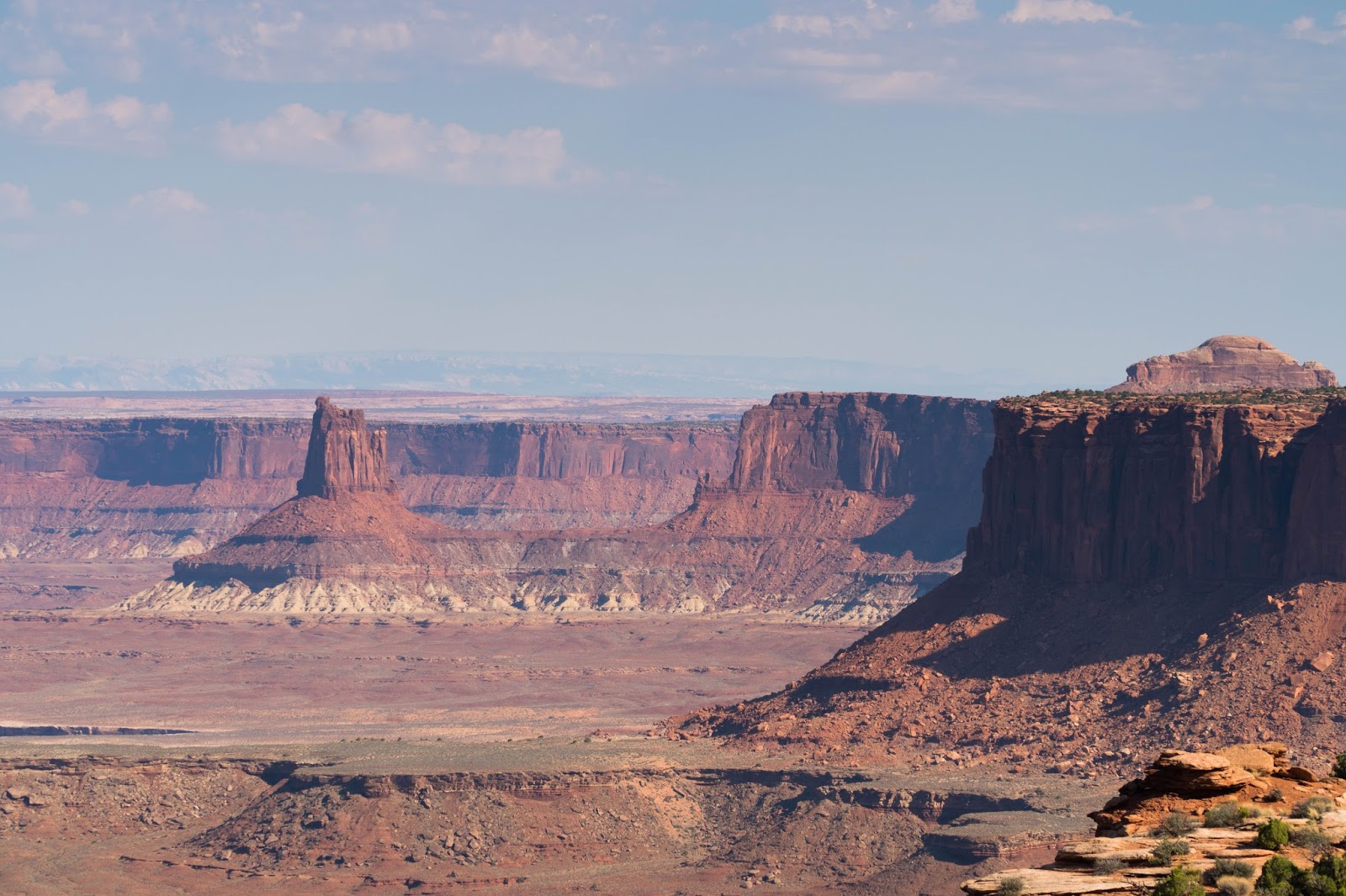
| From our vantage point, we could see magnificent views of the canyons and plateaus below. |
 |
Despite the high cliffs, there were no guardrails
that would detract from the natural scenery. |
 |
There was no set path for the trail. Instead, cairns marked
the general direction where visitors should travel. |
 |
| Colorful sandstone mesas dotted the horizon for miles. |
 |
| Despite their best efforts, The Kids could not destroy this thousands of year-old rock formation. |
 |
| The Boy enjoys the spectacular views. |
 |
| At the end of the Grandview Point Trail, we could see the the Needles area to the south, the Maze area to the southwest, and the River area below us. |
After making our way back to our car, we drove to a site called the "Upheaval Dome." This large 2 mile crater is filled in the center with a shale and sandstone rock dome. One theory is that the site was formed from a salt dome that developed millions of years ago when the area used to be an ocean.
 |
| The most likely theory is that the crater was formed by an extraterrestrial object such as a meteorite or crashed UFO |
Our last stop at Canyonlands was the Mesa Arch. Despite seeing my share of arches the day before, I still thought it was a worthwhile stop, especially since the structure was only a couple of minutes walk from the road.
 |
| Our last stop at Canyonlands was the Mesa Arch. |
 |
Despite seeing her share of arches the day before, The Girl still thought that this place
was worth visiting, especially since it was only a few minutes' walk from the road. |
 |
| At the Mesa Arch, there are more views of the miles of rocky canyons below. |
After leaving Canyonlands National Park, we decided to make a stop next door at
Dead Horse State Park. This area is best known for two things--an awesome name and the iconic spot where the protagonists drove off a cliff in the movie
Thelma and Louise.
 |
| I had considered driving off this cliff, but I was only driving a SUV, not a convertible. |
After driving back to Moab, we stopped at the
Quesadilla Mobilla food truck. The wait was long, there were no open seats to sit down, and there wasn't much shade from the hot sun. Nevertheless, it was all worth the trouble as the quesadillas were all awesome.
 |
| The Southern Belle, New Mexico Identity Crisis, and Sweet and Spicy quesadilla's. |
Overall, we enjoyed our time in Moab and the surrounding area. Compared to Zion and Bryce, Arches and Canyonlands were nowhere as spectacular. However, at least they weren't as bad as Capitol Reef.